


Mysteries, Oddities, and Everything Strange: Hector the Convector
March 21, 2023
Hector the Convector: A Timely Fellow
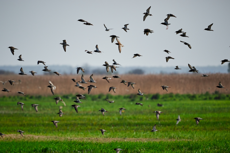
Thunderstorms can be pretty terrifying. They are gigantic balls of dark gray clouds that roll into town like bulls and wreak havoc on homes and businesses. They can cause power outages, floods, and more disasters that can put communities on hold for days. The unpredictability of these storms is one of the worst factors: the presence of a storm is virtually unknown until weather stations report it, and even then they can show up unannounced. If they were predictable, their damage could be easily controlled. But what if it showed up every day at the same time?
 The southern hemisphere experiences summer when the northern hemisphere endures winter, so thunderstorms are commonplace in our colder months: and that is exactly when Hector the Convector makes its debut. In Australia’s northern reaches, there exists a cluster of islands known as the Tiwi Islands. This archipelago welcomes a guest practically every day from September to March at three o’clock in the afternoon. A singular gigantic thunderstorm that is so regular that the Bureau of Meteorology dubbed it Hector the Convector.
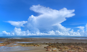
People in Darwin, a city on the main coast of Australia almost 62 miles away, see a crowd of people every day gather on the city’s edge to photograph the formation of the storm. The storm is able to reach a height of about 66,000 feet into the sky. From a distance (like the spectators witnessed in Darwin), the storm has great vertical development and appears to look like a mushroom. The nature of the wind above Australia makes storms of this caliber nearly impossible in this season—so how does Hector do it?
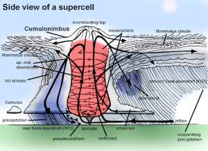 The sky above the Tiwi Islands, remarkably, breeds the perfect conditions for these thunderstorms to form. Many different columns of wind and air converge in the skies above the Tiwi Islands and go up, colliding with water vapor and eventually forming massive storm clouds. The tropical nature of the air and surroundings also contributes to this, as they are readily prepared to instigate thunderstorms given the opportunity due to their moisture. Hector regularly extends past the summer months into the rainy months that mark the transition between summer and fall, even reaching into April.
Hector causes much more than a spectacle when it rolls around. The surrounding areas are pelted with an unbelievable amount of rain and downpour. The islands’ airport, Pirlangimpi Airport, experiences about 80 inches of rain a year. In comparison, the average precipitation of New Jersey reaches around 40-45 inches per year. It is over double the amount of rain that Los Angeles experiences every year. The conditions that produce Hector are very precise, so any slight changes to the wind pattern or flow will prevent Hector from arriving with its full force.
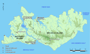 How did Hector even get its name? Well, the moniker dates back almost 80 years to World War II. Naval and aerial officers traveling between Darwin and Papua New Guinea grew accustomed to the presence of the storm and decided to give it the name. During the war, pilots and sailors would use the storm as a directional anchor and navigate based on its presence. Only hurricanes (or typhoons (or monsoons)) receive the honor of a name, but Hector gained this honor due to its regularity. The main islands of the Tiwi island cluster, Melville and Bathurst, rely on the storms for rainfall and support of the natural features of the environment. Both also have a high peak that the storm centers around and uses as a basis for its constant barrage of thunder and lightning.
The storm is one of the most popular for meteorologists to study and examine. Satellite imagery and rendered depictions help these scientists study the impacts of air movement and the interactions of water vapor and air gusts in the highest parts of the atmosphere. Altogether, Hector is a force to be reckoned with and a legendary weather phenomenon. Its explanation is pretty scientific and does not leave a lot of room for mystery and speculation, but who doesn’t love a thunderstorm named Hector?
The impacts of changing weather and global conditions might make the storms much more intense or cause them to disappear altogether, and the true impacts won’t be known until they take shape. One fact is known, though, and that is that Hector the Convector is a notorious figure in northern Australia and the Tiwi Islands, and it will continue to be for as long as it sticks around.
Resources:
https://www.cnn.com/2022/04/02/weather/weather-thunderstorm-hector-australia/index.html